Showing posts with label Climbing. Show all posts

Saturday, September 22, 2018

Mt Rolleston

3:20am Headlights on as Dad and I begin wandering up the Otira Valley under a sky glistening with stars, the surrounding mountains faintly glowing in the moonlight.

4:50am Crampons donned at the base of the Otira Slide.

6:50am The first rays of sunlight stream onto our faces as we crest the col at the top of Goldney Ridge after a long, calf-destroying climb up the firm couloir.

7:50am Time for a second breakfast on the Low Peak of Rolleston (2212m) to replenish energy levels.

9:00am A short step of ice and snow-covered rock has me asking for the rope.

9:30am We break out the celebratory chocolate on the summit of Mt Rolleston (2275m). It’s rush hour - two other trios arrive before we head back down. With not a wisp of cloud and nary a breath of wind we take our time to enjoy the views.

11:15am A leisurely lunch on Low Peak before descending the sun-softened slopes.

12:00pm The snow is very soft, with each step plunging us in up to our knees (occasionally floundering up to the hip), so we resort to bum-sliding. Even this proves difficult except in the path of previous sliders.

2:00pm We linger beside the bridge across the infant Otira River, reluctant to leave the mountains behind.

3:20pm Relief as boots are removed at the car park after a thoroughly satisfying day.


Dawn on the Otira Slide

On the Low Peak of Rolleston, with the High Peak behind

Descending the Otira Slide

Thursday, February 8, 2018

Mt Brewster

Smooth, round stones. Cool, clear water. Bare feet. Fording the shin-deep Haast River provided a blissful foot massage to bookend our excursion.

Mt Brewster as seen from Brewster Hut. Photo: Jim Davidson
Post-Christmas the days were hot, sunny and windless; perfect for climbing mountains. In order to avoid the worst of the heat it was late in the afternoon before my parents and I, along with our friend Andrew, set off from State Highway 6 towards Brewster Hut, perched high on the shoulder of Mt Armstrong. The evening was spent relaxing on the deck absorbing the beauty and grandeur of the surrounding mountains, while also studying our route for the next morning. 

Six hours return. That's what the guidebook said to reach the summit of Mt Brewster via the west ridge.

It was crisp and clear when Dad, Andrew and I set off just after 5am. Headlights were only required for a few minutes, and extra layers of clothing were soon stripped off as well. To begin with there was a rough trail to follow but then we continued sidling high instead of dropping down to the Brewster Glacier. Gradually the rock gave way to patches of snow and we donned crampons several times before finally reaching the lower slopes of Brewster. Andrew's crampons immediately showed signs of disuse with one strap disintegrating in his hands. Cable ties and a little ingenuity soon had a solution in place. We traversed low across the southwest face before climbing steeply up to the west ridge. For both Andrew and I it was our first serious climb in a while so it took time to get back into the swing of things. Front pointing in soft boots and old, dull crampons showed me how much I now take full shank boots and sharp crampons for granted. The morning was truly glorious and it was exhilarating to be high up in the mountains again. 

Andrew, Heather & Jim with Mt Brewster behind. Photo: Jim Davidson
Once on the ridge, the rock deteriorated to a pile of choss, requiring caution and careful testing of every hand hold in order to avoid raining rocks down on those below. Everything went swimmingly for a while as we worked our way along until the ridge began getting very narrow and exposed. We knew we were nearing the crux of the route which involves a short abseil down a vertical step. We also knew we were nearing or turnaround time of 2pm. So much for 6 hours return. Dad went ahead to reconnoitre while Andrew and I discussed the pros and cons of continuing. Getting the go-ahead from Dad, we roped up to proceed another 20 metres or so, which included standing atop a rock with nothing below on either side. After making this progress we promptly decided that were having an enjoyable day in the mountains and there was no need to push our comfort zones to tackle the crux and the final 60m scramble up loose choss to the summit. So we retreated with absolutely no regrets.

The chossy ridge. Photo: Andrew Shepherd
It was hot and calm so on reaching a less exposed spot we rested for quarter of an hour contentedly munching delicious chunks of Christmas cake. What a fantastic way to spend a holiday! Carefully picking our way back down the loose ridge took just as long as the ascent. Instead of dropping back down the steep snow slope we had come up we continued sidling down to the head of the glacier. Andrew's crampons once again needed emergency repairs, while I didn't completely trust my short, blunt crampons in the heat-softened snow. By this time afternoon cloud was starting to roll in around the peaks. Strolling down the Brewster Glacier was straightforward but hot. We were intrigued by a series of poles spaced out along the length of the glacier which were evidently scientific measuring equipment for studying glacial movement. Stepping off the toe of the glacier, we slaked our thirst from meltwater running down the rocks. These smooth, solid, ice-carved rocks were incredible and it was good fun scrambling along picking our way through the maze of humps and hollows. Such a contrast to the rock up on the ridge! 

Leaving Brewster Glacier. Photo: Andrew Shepherd
"Andrius!" We were back on the Mt Armstrong route and unexpectedly bumped into an acquaintance of mine from Auckland. Sometimes the great outdoors is truly a small place. Not long afterwards we were welcomed back to Brewster Hut by Mum, who had been patiently waiting for several hours past our predicted return time. We had doubled the guide book time without even reaching the summit! But we had thoroughly enjoyed ourselves in the process.

All that remained was to retrace our steps down to the valley floor, where the cool waters of the Haast River provided relief to hot, weary feet.

Monday, September 25, 2017

NZAC Girls Trip

The Auckland Section of the New Zealand Alpine Club organised a girls only trip to Mt Ruapehu, and last weekend found 10 ladies ensconced at the NZAC Ruapehu Hut at Delta Corner near Knoll Ridge CafĂ©. The objective was to walk up to the top of Pyramid (2,645m), one of Ruapehu's 12 peaks, but mainly to simply enjoy being on the mountain.


Three of us took the Friday off work to travel down and so managed to catch the last chair lift up the ski field - the others didn't arrive until about 2am! The afternoon was ridiculously warm with blue skies and a touch of lightly falling snow. Having skipped the walk up to the hut, I made myself useful and got some exercise digging out the fire exit.


Saturday morning was clear but a little breezy so I got up at 6am to watch the sunrise. The sky was clear all the way out to Mt Taranaki in the west, and the rosy light gradually crept over its slopes as it emerged from the shadow of Ruapehu. The late arrivals didn't emerge from bed until a while later, so it was just after 8am when we began wandering upwards. We opted to go up the gut and through the notch onto the Summit Plateau, where we were sheltered from the worst of the wind. There was blue sky all the way until we reached the southern corner of the plateau where we paused to regroup before heading over to Pyramid. I could see the peak with cloud billowing in front, but by the time everyone had caught up we were encased in cloud with almost zero visibility. Occasional clearances allowed us to find our way over to the north ridge of Pyramid, which we followed to the top. Despite being directly above the crater lake we didn't see it at all! It was cool and breezy on top so we only stayed long enough to take a few summit shots before retreating to a sheltered spot for lunch. Then it was simply a matter of retracing our foot prints back to Whakapapa. Some of us had hoped to traverse the ridge along to Te Heuheu, but decided it wasn't worth it in the wind and limited visibility. As we went through the notch and headed down toward the ski field we dropped below the cloud and once again had a view. Back at the hut in time for afternoon tea after a leisurely 6 hour stroll.


I poked my head out of the door at first light on Sunday to be greeted by a wet shroud of white and a blustery breeze. Oh well, back to bed. It wasn't worth trying to climb anywhere in the rain and wind so we simply packed up and walked down to the cars.

Sunday, July 9, 2017

Mt Arthur Mission

A quick, spur of the moment dash up Mt Arthur (1,795m) with a friend and friends of friends.

Driving across the Moutere Valley we could see the peak of Mt Arthur bathed in sunshine above a layer of cloud. This cloud promised to lift, and as we swiftly marched up the track from Flora car park we had sunny spells and glimpses of the surrounding country. Unfortunately the cloud only lifted to about 1,700m and the summit remained swathed in cloud.


There was a bit more snow than we were expecting which made it fun. The only really sketchy bit was traversing above a gully just after the Winter Peak turn off - the run out was awful! A couple of our party were in running shoes and I was the only one with an ice axe. We made it safely across but then met a couple descending who told us that the last little bit was trickier. Only two of us pushed the last 5 minutes to the summit as the others decided that they had come high enough without proper gear. A quick retreat off the mountain in thickening cloud saw us back at the car with plenty of daylight to spare.

A marvellous little adventure!

Familiar view on the summit!

18km, 5:20 hours return to Flora car park. (2:50 hours to summit)

Tuesday, August 16, 2016

Ringatoto

Mt Ruapehu is well known as the highest mountain in the North Island, but the volcano actually has 12 prominent peaks not just a single summit.

I climbed my first of the peaks before I was 10 on a family summer-time scramble up to Dome. The true summit, Tahurangi, was achieved in 2009 and at the time I found it pretty scary. Te Heuheu was memorable as my first solo alpine ascent, and my favourite climb was Girdlestone last year. Gradually the various peaks were ticked off the list until only one remained: Ringatoto.

The east ridge of Ringatoto

Escaping from work at lunch time on Wednesday, it was a long drive down to the eastern side of Ruapehu and halfway up the 4WD Tukino Road. The last flush of twilight faded as we set off through the snow towards Rangipo Hut. It was a glorious clear night with only the faintest mountain zephyr and a bright moon illuminating the landscape. The snow was soft and deep so crampons weren't required. Dad took on the unenviable role of breaking trail through the at times knee-deep snow. It was exhausting work doing repeated one-legged squats with a heavy pack.

Rangipo Hut

From previous tramps I expected to reach Rangipo Hut in 2 hours, but it was an extra 45 minutes before it finally appeared. Snow was piled around the hut and it took 10 minutes to clear snow from in front of the door. Once inside it was straight into our cozy sleeping bags, hoping for the snow to freeze overnight.

Still soft. Abandoning our original plan of traversing over Ringatoto to Tahurangi, around the crater lake then down to Whangaehu Hut we instead opted to leave our sleeping gear at Rangipo and simply tackle the east ridge Ringatoto. This meant lighter packs and far less post holing through the soft snow.


An intense orange glow spread across the horizon as we headed up the ridge behind the hut. Layers were soon being peeled off as the sun warmed us up and there was no cooling breeze. After an hour we donned crampons as there was a hard layer under the surface snow in places. The vista was grand: white-capped Kaimanawa Ranges to the east, to the north Ngauruhoe was cloaked in snow with Lake Taupo beyond, and Te Heuheu, Cathedral Rocks, Pyramid and Girdlestone forming the eastern ramparts of Ruapehu.


The easy ridge walking gave way to steeper terrain with a few sidling traverses and short mixed rock steps but nothing too difficult. We used the rope twice for security where there was loose snow on steep rock. The final pinch up to the shoulder of Ringatoto was up a steep firm gully - the only decent snow on the whole climb! We soloed up and I was reasonably comfortable, albeit tired by the time I topped out onto easy ground. A short stroll led to the summit. Peak number 12 accomplished!

On top of Ringatoto with Tahurangi behind

The weather was still perfect so we spent half an hour soaking in the grandeur of the mountain before retracing our steps. Dad belayed me down the gully, and then apart from a very short abseil down a rock step it was all straight forward back to Rangipo.


7 hours from Rangipo hut to Ringatoto
3.5 hours down


The 12 peaks of Ruapehu

Tahurangi (2,797m)
Te Ataahua (2,757m)
Paretetaitonga (2,751m)
Te Heuheu (2,732m)
Tukino (2,720m)
Dome (2,672m)
Cathedral Rocks (2,663m)
Girdlestone (2,658m)
Pyramid (2,645m)
Glacier Knob (2,642m)
Ringatoto (2,591m)
L Peak (2,580m)

Thursday, March 3, 2016

Mt Aspiring

The brave man is not he who feels no fear,
For that were stupid and irrational;
But he, whose noble soul its fear subdues,
And bravely dares the danger nature shrinks from.
~ Joanna Baillie
 
Often referred to as New Zealand's Matterhorn, Mt Aspiring has a distinctively aesthetic profile. At 3,033m it stands as one of NZ's 25 highest mountains and is also one of the more achievable 3,000m peaks. Ever since another climbing / tramping expedition 2 years ago, where we camped in sight of Mt Aspiring, I have harboured the desire to reach the summit. 

 
It was getting a bit late in the season but we pencilled in late-February for the climb. A close eye was kept on the weather forecast so when Metvuw showed a few days of settled weather arrangements were hastily made. Dad and I soon found ourselves in Wanaka ready to head into the mountains.
 
With a limited weather window and work constraints we opted to helicopter in to Bevan Col in order to save two days of arduous tramping. From the col it took 2 hours to cross the Bonar Glacier - another new experience for me. I took the time to peer down into a few crevasses but most were fairly small and easily stepped across. Colin Todd Hut stood out like a beacon up on Shipowner Ridge. The hut windows look straight out at the summit of Mt Aspiring and the Northwest Ridge, so we were able to get a good look at our planned route.

 
4am. Time to get up. With clear skies and a full moon it was quite light outside and the mountain stood out clearly. Geared up and out the door before 5am, it was half an hour up the rocky path to the snow slope above the Iso Glacier. Crampons on for a nice plod up to the NW Ridge. Dawn broke and the red moon set as we abandoned crampons for the rock on the main ridge. Immediately there was an airy ledge to traverse so the rope came out (and stayed out until this spot on our return). Dad short-roped me for most of the climb; simulclimbing in a few places and belaying on the sketchier bits.
 
I was really noticing the exposure on the ridge and was not too happy with having nothing on either side for a couple of hundred metres below! Inching across a ledge with your heels hanging over mid air and fingers clinging to small pockets in the rock it a little terrifying. Halfway along the ridge I got pretty petrified on a traverse and almost decided to turn back. Only the thought of everything we had poured into this trip, and the desire not to fail, kept my moving forward. A few moments on solid ground clinging to a rock to regain composure and I resolved to carry on. I was here to climb the mountain - I had to trust Dad and his judgement. With perfect weather conditions we had to give it our best shot.
 
I wore my tramping shoes along the rock ridge for better grip and manoeuvrability but it meant that my pack was heavy - carrying boots as well as crampons and iceaxes. It also meant that we had to avoid the small snow pockets on the ledges. Switching back to boots and crampons for the summit snow cap I was much happier to have solid snow beneath my feet. There were still several hundred metres to climb, including plenty of mixed snow and rock which meant whipping crampons on and off as well as walking on rocks with crampons. The final steep slope up to the summit was hard but steady work.
 
Finally, after 8:35 hours we reached the top. My first 3,000m peak! The weather was so clear and calm that we spent 20 minutes taking photos and resting, picking out other mountains such as Earnslaw, Tutoko, Sefton, and Mt Cook in the distance.

 
We still had a long way to go. Coming down the snow was relatively quick, and once back on the rock of the NW Ridge we took a slightly different route in places to what we came up. I kept my boots on instead of switching to shoes in order to make use of the ledges with snow on, however this meant that I was even less confident on the rock slabs. A true climber would have been horrified at my technique - plenty of knees and bum shuffling - but it got the job done (albeit slowly).


We did one abseil off the buttress, which I actually enjoyed after the first few metres of learning to trust the rope. It was now getting late and I was tired but focused on getting off the mountain safely. I was hoping to get off the rock section while it was still light and it was a huge relief to finally reach the snow just as darkness fell and the cloud swirled in. With footprints to follow it was an easy plod back to the hut but it took a lot of concentration to stay awake and not make any stupid stumbles.
 
At last the hut appeared. 17 1/4 hours after setting out we had returned victorious!
 
 
The 'walk' out via Bevan Col the next day was itself an adventure, with steep exposed rock slabs and 4 abseils!
 
Two questions which I have encountered frequently since the climb are:
  1. Was it fun?
    In short, no. I am glad I took on the challenge but I can't really say I enjoyed it. Definitely type 2 - 2.5 fun (definition).
  2. What is next?
    At this stage I don't have any other big expeditions in the pipeline.
 

Monday, November 30, 2015

Girdlestone - Mt Ruapehu

The clear sky was brilliantly orange to the east as we set off from Blyth Hut at 5am. Three hours of walking up the volcanic boulder fields brought us to the snowline on the south face of Girdlestone (2658m), where it was time to gear up with crampons, ice axe, harness and helmet. A steady plod up gradually steepening snow for a while before the ropes were hauled out. The conditions were great for cramponing, each foot biting firmly into the snow.

The first couple of pitches were nice and easy allowing us to get our systems sorted and practice rope handling. This was my first time leading and I relished the opportunity to put into practice the skills which I have slowly been absorbing over the years. The route steepened but at no time was I outside, or even on the edge of, my comfort zone.


6 pitches brought us to the summit ridge and then another two pitches, including a rock step, led to the top - 11 hours after setting out. We basked on the summit for an hour before descending down the Mangahuehu Glacier on the north east side. By this time the snow was soft so it was easy trudging down the slope. Once off the snow it was a long plod back down the flank of Ruapehu towards Blyth Hut. 


Five minutes before the hut we watched as the vividly orange sun sank below the horizon. A glorious end to a glorious day. 15 1/2 hours on the go, 1,300m ascent, 8 pitches, lots of learning and loads of fun!


Tuesday, February 25, 2014

Rees - Dart (a variation)

Two weeks of climbing and tramping in the Wakatipu region - not a bad way to end the summer holidays.

I caught the first flight down to Queenstown on Wednesday morning and rendezvoused with Dad, Denis, & John. Spent a few hours planning and organising gear before heading out to Glenorchy to start our adventure. The plan was to firstly climb Mt. Earnslaw (2830m) after which Denis & John would head out, taking some of our climbing gear with them, while Dad & I would carry on up the Rees valley for another week of tramping and climbing.


Day 1: It was a hot slog up the Rees Valley from the car to the turn off to Kea Basin and Earnslaw Hut, and then a 500m climb up to the rustic bivvy. Laden with climbing gear, camping gear, and 12 days of food, my pack was the heaviest I had ever carried (estimated 16-17kg) although it was still lighter than the rest! Earnslaw Hut is a 4-bunk bivvy constructed from corrugated iron and beech poles. The top bunks were good old-fashioned sacking slung between poles. We hung some of our food from the rafters to be collected on our way back down - we didn't want to haul to much unnecessary weight up 1200m to the next hut.

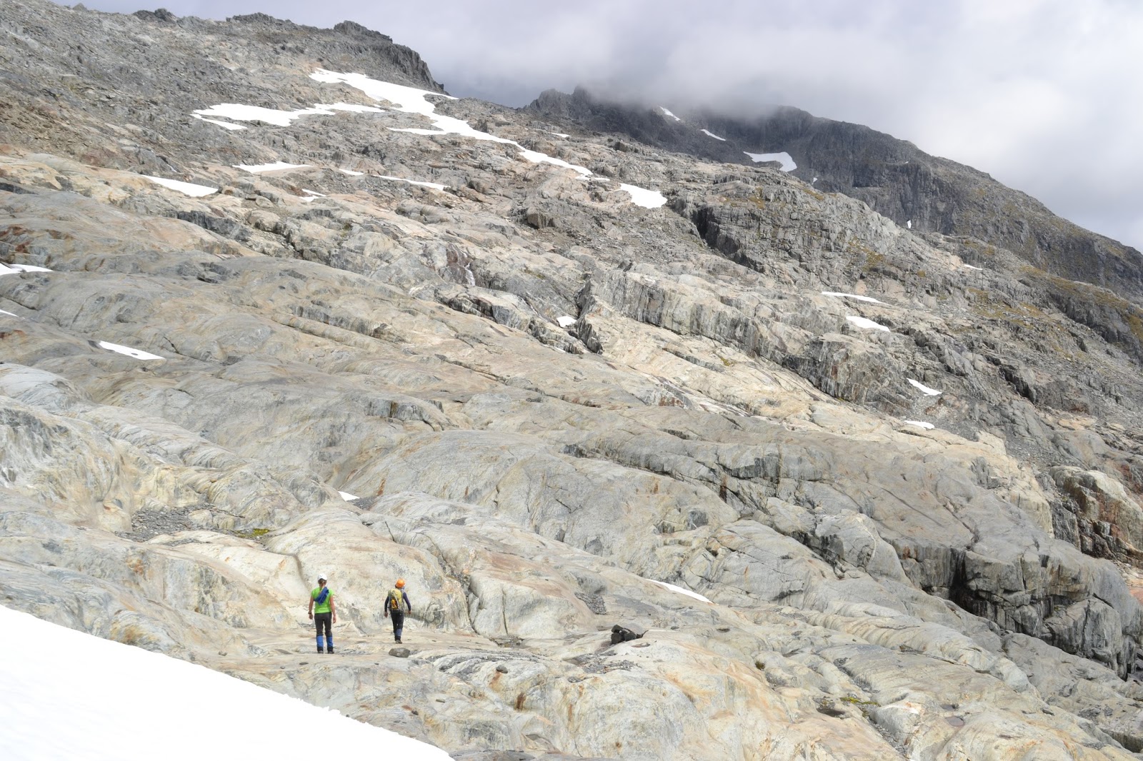
Day 2: A leisurely breakfast saw us depart around 9am. We had just joined the track up to Kea Basin when a party of 3 came up behind us. "That wouldn't be Jim Davidson would it?" Turned out that one of the party was one of Dad's old adventure racing team mates! It's a small world. Low cloud hung around the tops in the morning but around 10:30am everything suddenly cleared and we could see our objective: Mt. Earnslaw. Our destination for the night was Esquilant Biv, perched near Wright Col on the shoulder of Earnslaw at 2200m. That meant 1200m of steep track to climb, and Denis & John struggled a little. Crampons were donned to ascend the snow slope of the Birley Glacier to Wright Col, and we reached the hut around 6 hours after setting out. It was a glorious day with no clouds and little wind so we sat outside the bivvy to soak in the grand view and eye up the imposing face of Mt Earnslaw. We squeezed 7 people into the 6 bunks - enough room for sleeping but not much room to maneuver in the cooking / storage area. Water had to be fetched from melting snow 5 minutes away.


Day 3: Up at 6:30am after waiting for Ross's party to leave. Took an hour to have breakfast and get kitted out before heading up the scree slope from Wright Col. From the Col to the summit is a climb of 600m. Denis was in a bad way from the beginning, suffering from nausea and a headache. John (a doctor) was quite worried about the symptoms but Denis insisted on carrying on. From the top of the scree we scrambled along rock ledges following the cairned route. The crux was a boulder called the 'keyhole' where you could either wriggle up a couple of metres through a narrow gap between the boulder and the cliff, or climb around the outside above a very long drop. Denis & I wormed through the gap while Dad & John took the easier but more exposed outside route. From there we popped out onto scree which led up to the summit. 3:15 hours from hut to peak.
The Keyhole
Ross's party had taken a different route and reached the top at the same time as us. Spent a long time on top before heading down together. Used the rope to descend the keyhole (mainly for confidence). Reached the col in 2:15 hours.
 Relaxed with hot soup at Esquilant Biv before packing up and heading back down to Kea Basin. Denis was still struggling but bravely soldiered on. It was a long descent and my legs were very tired and a little shaky before the end (roughly 3 hours down from Esquilant). We had planned to spend the night in one of the rock bivvys in Kea Basin but when we arrived we couldn't find any clean water nearby so we carried on another 15 minutes to Earnslaw Hut. Some very weary bodies that night!


Dad & I on top of Earnslaw


Day 4: Woke up with extremely tight legs thanks to the 1800m of descent on the previous day, much of it with a heavy pack. Headed down to the Rees Valley where Dad & I loaded Denis & John up with the gear we no longer required such as rope, helmets, and harnesses. Those two slowly made their way back down valley to the car while Dad and I headed further up the valley to Shelter Rock Hut. My quads were
screaming blue murder at me so my pace was pretty slow. On top of that I was quite weary from poor sleep and not eating enough over the last couple of days. As is usual at the start of a long trip we were trying to ration our food, but a couple of big days really required more. It took us 1 hour down to the Rees and a further 5 hours to the hut. Had lunch by the river at Slip Flat and had a splash to cool down. Another cloudless day meant hot work. Quickly settled into the flash hut (complete with flush toilets!) and had a proper wash of both bodies and clothes. Other trampers gradually trickled in and the hut was soon full. There were several tents pitched out the front while a few people slept on the floor inside.

Rees Saddle
Day 5: Low cloud in the morning so we took our time to pack up hoping it would clear. No such luck so we headed off just after 7:30am. A gentle climb up to Rees Saddle then along a tussock bench above the dramatic Snowy Creek to Dart Hut, in cloud the whole time although we could see down to the gorges of Snowy Creek. 4 hours to Dart Hut. Had lunch in the hut, where a party doing their Duke of Ed. gave us a sandwich to complement our cheese and crackers. We headed off with satisfied stomachs and the weather soon cleared to bluebird skies. The Dart glacier was reached after 3 hours, then it was a long hot climb up to Cascade Saddle. By this time we were pretty footsore and weary. From the saddle it was still another 50 minutes along (and up) to the campsite at Cascade Stream below the pylon (at 1560m). Just before reaching camp I had a falcon land right in front of me which was a neat experience. It wasn't worried about me at all despite being less
than 10 metres away. That made my day! I was shattered so left Dad to set up camp. Mt Aspiring could be seen clearly from our campsite, as well as Mt Tyndall and Mt Ansted which we hoped to climb the next day. 10 hour day, including a 1 hour lunch break.

Day 6: Alarm went off at 5:30am but it took a few minutes before we actually crawled out of our sleeping bags. Breakfast under a clear sky with the mountains visible in the pre-dawn light. We packed up all our gear, including the tent, and stashed everything in the DoC toilet to keep it safe from raiding keas. Our climb started with a 200m climb straight up the track to the pylon, where we left the track and followed the ridge. Undulating to begin with, the ridge soon deteriorated into steep, loose rock and we reached snow after an hour of walking. Crampons on to ascend the easy snow slopes of the Isobel Glacier towards the summit of Mt Tyndall (2496m). A slight mountain zephyr (enough to warrrant my putting on a coat) but otherwise the weather was perfect. Upon reaching a shingle slide near the top we kept our crampons on as this gave a more secure footing on the small, loose rocks. Even when we reached the summit rocks we kept crampons on, as they bit into the
Mt Tyndall
crumbly weetbix-like rock as if it were firm snow. Only the final few metres up a solid corner required the removal of crampons (and a few careful moves). 3:10 hours after leaving camp we had Tyndall in the bag. Fantastic views - the Shotover & Matukituki valleys underneath, mountains all around with Aspiring, Earnslaw, Tutuko, and even Mt Cook in sight. Descending the weetbix rock was rather sketchy and I was glad to reach the snow again.Strolled along the Isobel Glacier to Mt. Ansted (2.5 hours) but didn't quite reach the top. The final 50m or so was steep, slabby choss, and although it was probably climbable we would have wanted a rope & protection (which we didn't have) due to the long drop below. We settled for lunch on the edge of the snow before trudging back along the Isobel Glacier. It was pretty warm by now and Dad was plugging steps in the soft snow. Returned to camp after 9.5 hours. An absolutely magnificent day!
Heading back along the Isobel Glacier
From Mt Ansted. (Tyndall top right)


Day 7: Woke to cloud around the peaks which gradually lowered and threatened to rain. Headed down to Dart Hut for lunch (4 hours). Had planned to carry on another couple of hours to the rock bivvy at Cattle Flat but it started to rain while we were eating so as we were rather weary we allowed ourselves the luxury of staying at the hut. The weather gradually cleared and by late afternoon the sun was shining and Mt. Ansted was in clear view up the valley.

Day 8: Low cloud and very light drizzle slowly cleared. The track down the Dart valley was nicely benched through beech forest down to Cattle Flat. Here we shared our lunch with the sandflies before popping up to have a look at the bivvy. Quite a large overhang with a rock wall built in front. Plenty of room to pitch a tent underneath if desired. Daleys Flat was reached in 6 hours, and we pitched the tent at the top end between the river and the track. Hordes of sandflies!  All I really wanted to do was sit still & relax but the sandflies were too persistent. We retreated to the tent and later the bush to escape their clutches. Retired to bed early, and although we entered the tent quickly we then spent over half an hour exterminating the sandflies which had managed to enter with us.

Day 9: Cooked breakfast in the bush above the river to avoid the worst of the sandflies, although they still found us. Popped our noses into Daleys Flat Hut before starting through the beech forest. The track around the new lake at Dredge Flat is quite rough in places although there has been enough foot traffic for the route to be easily followed. The massive slip which caused the lake is quite impressive and the outlet/river now flows through the trees on the true left. I started to run low on energy after Sandy Bluff (end of the lake). We hoped to cross the Dart River to head down the true right to the Lake Sylvan track, but the river didn't come to the party. Dad attempted to cross by the Beans Burn but the water was too swift. He tried again below Chinamans Bluff and got most of the way across but was stopped by the final, narrow channel. While Dad was thus engaged I was entertained by a friendly robin feasting on the sandflies which swarmed around our packs. When I sat still it even pecked the insects directly off me! Thwarted by the river, we carried on out to the carpark at Chinamans Bluff where we managed to get a ride out to Glenorchy with a couple of DoC workers. 6 hours including lunch and an hour spent attempting to cross the Dart.

Our trip turned out to be a little shorter than planned - 9 days instead of 12, but we had a marvellous time. After a couple of days recuperation in Queenstown we headed up to the Remarkables to do a Grand Traverse of Double Cone & Single Cone.

Esquilant Biv


Shelter Rock Hut

Our campsite above Cascade Saddle
Mt Aspiring in the background


On top of Mt Tyndall
(Earnslaw back right)
The new Dredge Lake

Climbing Double Cone


On top of Single Cone